The Gorse Fox has been playing around with Google Maps. Below is an experiment. It (hopefully) shows the map of the route against the aerial photo of the this part of the Downs and attempts to indicate where various photos were taken during the walk. (This includes several photos not featured in the blog entries below).
View Larger Map
Showing posts with label South Downs. Show all posts
Showing posts with label South Downs. Show all posts
Wednesday, January 02, 2008


Walkover
 It was the first walk for several months and though it wasn't far, and was not too demanding - GF was not pleased at his level of fitness.
This should have been easy, but he actually found the last mile or so hard going. Anyway, the statistics are:
Distance: 8.2 miles
Highest point: 620 ft
Lowest point: 22 ft
Total ascent: 870 ft

Final stretch
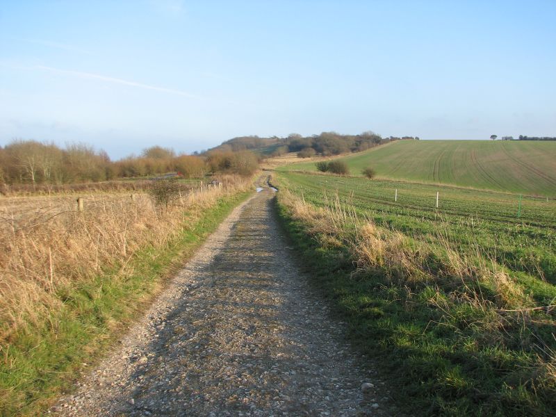 This picture records the last half mile of the walk - along the South Downs Way, eastwards towards the car park from whence the Gorse Fox had set off.
He was finding it hard going - partly because his fitness had obviously declined, and partly because of the strong headwind.
He was out for two and half hours - saw one bunch of ramblers near Burpham, and two dog walkers near the car park on his return.
It had been a really nice walk and a good way to start the year.

Solitude
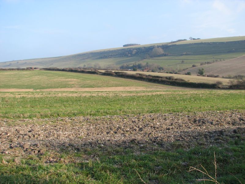 The Gorse Fox had been walking for about 90 minutes. Some 5 miles or so were under his belt (so to speak).
He mused that he seemed to have the Downs to himself. He had not seen another living soul. (Strictly speaking, he hadn't seen any dead ones either - just in case you were wondering).
As if conjured up by his very thoughts he turned a bend only to be faced with a cluster of crusty ramblers coming in the other direction. They called cheery "Hellos" as they passed, but somehow they had broken the spell.
Turning the bend had also pointed GF directly into the wind as it scoured the Downs. This made the going a little slower than normal as he continually had to wipe his eyes (and nose) as he headed north-east.
Wepham Cottage and Burpham
 Gorse Fox knows that he has featured Wepham Cottage before, but he cannot resist including it once more, It is such a quintessentially English cottage that you expect to see Miss Marple appear at the door.
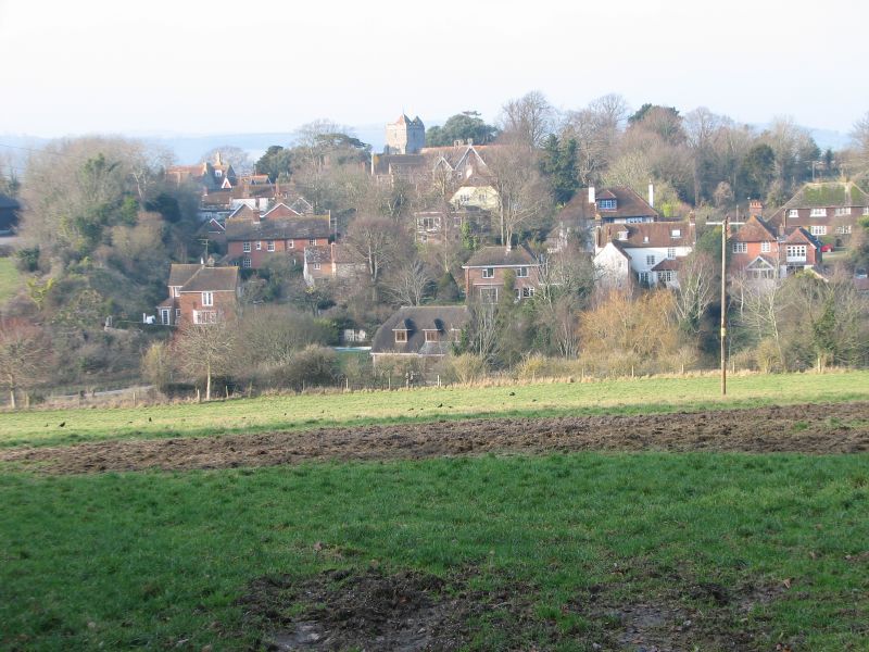 Moving though Wepham the hedges fall away leaving this view across the field to Burpham. Again, it looks as if it has been peeled from a chocolate box. The church dominating the village, and all of the little houses clustered around on the high ground above the floodplain of the Arun to the left.
Earthworks
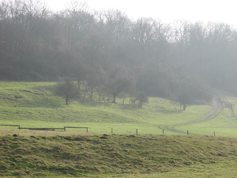 Walking between the hillside over here on the left and the gallops on the right the weak winter sunshine helped emphasize the earthworks on the hillside and track that led up into Tenantry Copse.
This whole stretch of the Downs is criss-crossed with many different earthworks. It isn't clear whether they are defensive or agricultural. The GF suspects that they are mainly agricultural.
Towards Norfolk Clump
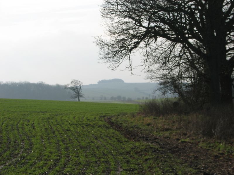 The route continued down from Springhead Hill and across Wepham Down towards Norfolk Clump - the small copse that crowns the hill in the background.
It was very wet under foot - and the path had been churned up by horses using the route across the Downs. GF skidded here, leapt there, splashed everywhere - and as he continued to slip and slide he mulled over the elegant sight that he must be from a distance and realised that any distant viewer would marvel at his lightness of foot and compare him with Nuryev or Baryshnikov.
Into the sun
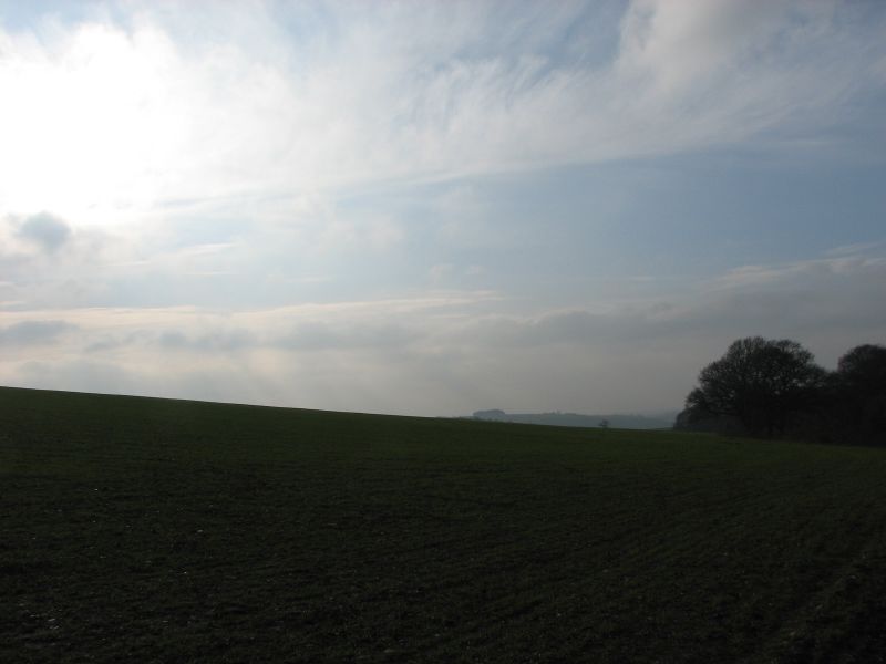 It was clear, once the Gorse Fox was out of the car that there was (as forecast) a bitterly cold south-easterly wind scouring the Downs. He was glad of his new fleece and hat. (The erosion of hair covering from the Gorse Fox's cranium - whilst not as bad as some, has left a significant "solar panel" at the back of his head and through this he has a propensity to lose considerable amounts of heat).
The sky was a watery colour with a weak sun trying hard to penetrate the cold below. Whilst it never actually warmed up - the wind did blow away the early clouds. Walking in to the low sun filled each view with deep contrasts of the bright sun against the deep long shadows of winter.
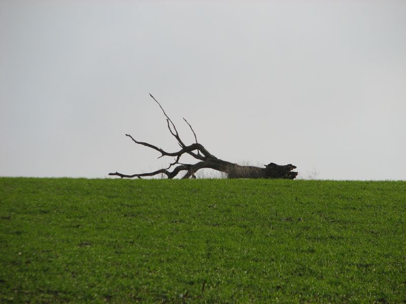 Somehow this image seemed a perfect illustration of winter - the skeletal remains of an old tree - still lying where it fell and pointing accusingly at the wintery sky.
Walking from Kithurst
 The Gorse Fox decided that a walk was on the agenda for the day. After perusing the folder of planned routes he chose this one.
The walk starts at the Kithurst Hill car park at the top right of the map. Following clockwise it starts by heading south until we pick up the gallops (as in horse racing - not a gastric complaint). Hugging the edge of the hill and the gallops it turns south west until it reaches the Knell where it turns north over The Conyers and down into Wepham.
From Wepham the route follows the road towards Burpham but diverts round the east of the village up to Peppering High Barn. Here the route turns north-east and runs straight for a couple of miles back up to whre it intersects with the South Downs Way and turns east back towards the starting point.
Saturday, July 14, 2007
Glynde - Lewes Route Profile
 GF was a bit lethargic and was not really in the mood for a walk, but he is so glad he forced himself. This was a superb route through some of the nicest parts of the Downs.
This was the profile for the walk.
Distance 6.5 miles
Total ascent 1400 feet, with a maximum elevation of 462 feet, and a minimum height of 7 feet above sea level.
(If you want to see more photos from this walk, then look at the Glynde - Lewes photoset on my Flickr account).
Update: GF has also made a Google Map of this walk with more photos. This is best view in the "hybrid" view.
 From Saxon Down, the Gorse Fox climbed back into the field where he had started the climb to Mount Caburn, but sticking to the northern edge found his way down a little used farm track to Home Farm, and the village of Glynde once more.
Glynde has a huge reputation for such a small village. It hosts a Food and Drink festival and is also known for its link with opera (the art form, not the browser). On 28th May 1934 John Christie whose family had lived at Glyndebourne an old Tudor manor since 1617, opened the Glyndebourne Opera House. The building catered for about 300 people, and became synonymous with English Opera. In 1992 the building was demolished and a new one contructed, this was opened in 1994 seating 1150 people. Glyndebourne is now the major operatic centre in the UK.
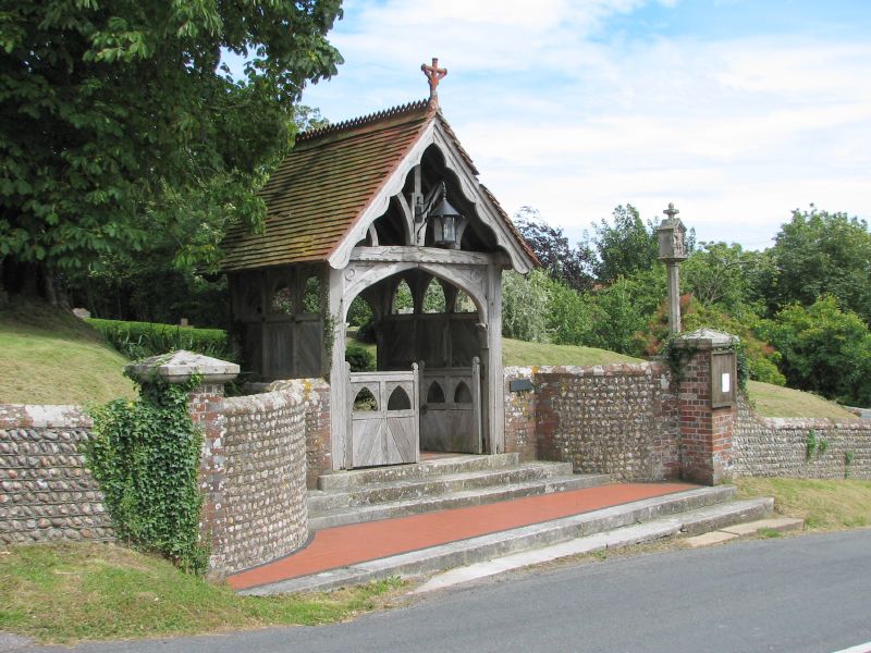 Walking down through the village GF was struck by the elegance of this old lychgate. The weathered oak has evidently stood firm years, the Sussex flint wall setting it off against the churchyard beyond.
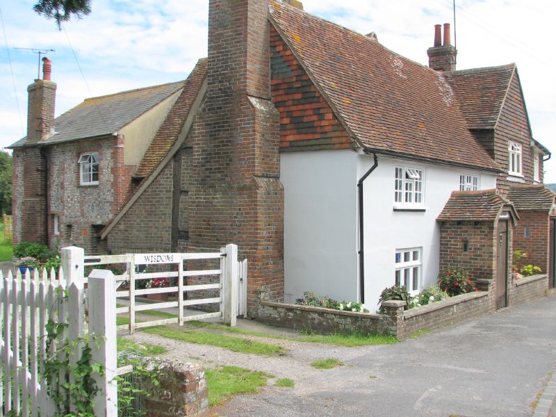 On the final stretch back towards the car, GF saw these cottages. He had noticed them earlier but this view shows the various changes that have adapted the cottage over the years.
A couple of hundred yards later GF was back at the car and getting ready for the drive home. A cyclist kicked up a cloud of chalk dust as he came to halt by the next car. "Good day for it" called the Gorse Fox, "Oui, monsieur" responded the cyclist. "It was windy up near the top of Mount Caburn" offered GF. "Oui, zo I voz at Bitchy Head" responded the Gaul. GF couldn't help bu wonder if he had taken a wrong turn last week and was desperately searching for the rest of the peloton who were, by now, climbing mountains the other side of France.
Saxon Down
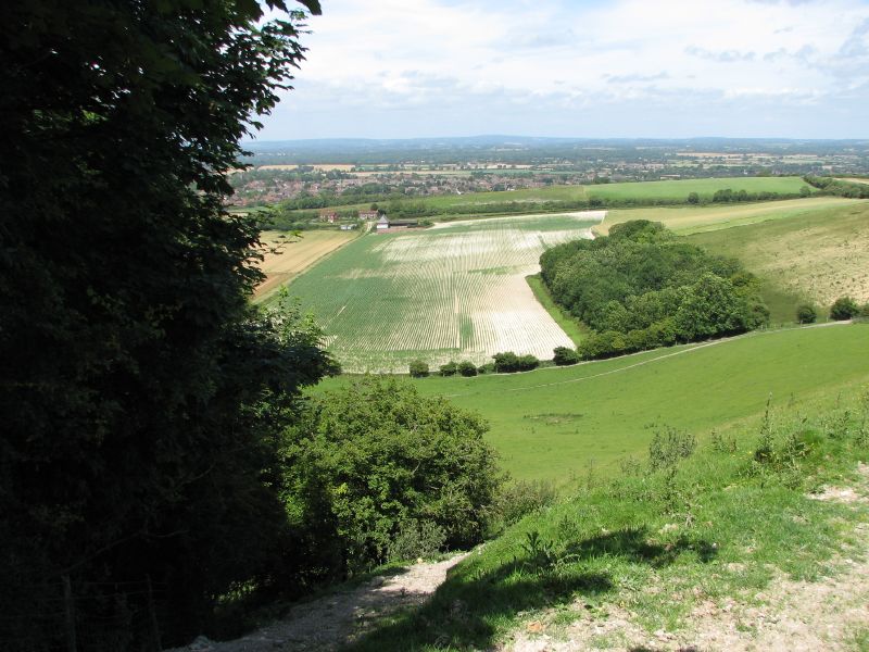 The southern edge of Saxon Down skirts a steep drop at Saxon Cross. Dense undergrowth protects the edge, but as it ends the ground drops away to the Weald below.
GF cannot find much about Saxon Down, but it is scattered with tumuli, so obviously had some significance to ancient or medieval man.
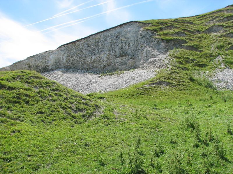 On the eastern side of the Down is track (possibly called Week Lane), carved deeply into the chalk by years of use. As it climbs around the high point, the side of the hill is scarred by old quarrying and the spoil heaps that were left.
Bible belt
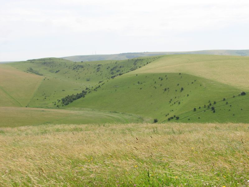 Having climbed back up near Cuilfail, the Gorse Fox headed across the Golf Course - watching carefully for strangely dressed men with wayward balls swinging in from the left or the right. (In this part of Sussex, you can never be too careful).
Once clear of the golfers, GF had the Downs to himself again. Traversing the slope of Cliffe Hill, GF got this view up along Caburn Bottom - you can see as it zigs and zags climbing slowly up to the Mount.
 This seemed like an ideal spot for a short break. The Gorse Fox shrugged off his rucksack, and dropped his camera, map and GPS to the ground. What an idyllic spot for lunch. Delving into his pack, he retrieved one of Ginster's finest, and a bottle of carbonated water.
As he ate he watched as the waves of colour marched across the hill, driven by the stiff summer breeze. Finally, he twisted the cap on the bottle (carefully) and freed the imprisoned carbon dioxide. Fly away little molecules. Be free!
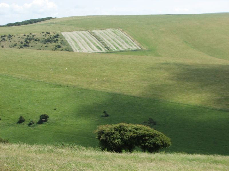 Finishing lunch GF set off again. He was walking along the upper edge of Bible Bottom and peering down into its depths looking for the earthwork that gave it its name.
It suddenly occurred to the Gorse Fox that it was staring him in the face. This wasn't a partly harrowed field on the side of hill - it was the "The Bible". Not sure what page it's open on... but that's it.
(Interestingly, there is picture, owned by the Victoria and Albert Museum, of Bible Bottom painted in 1881 by the artist Hine)
Not Morse
 Near the entrance to Golf Club, the road teeters on the edge of the chalk cliff looking down over Lewes.
Hugging the banks of the River Ouse and dominating a gap in the South Downs, Lewes is the County Town of East Sussex, and it sits on the Greenwich Meridian. The town was the site of the Battle of Lewes in 1264. It is the location of several historic buildings, including Lewes Castle, the remains of Lewes Priory, and the so-called "Anne of Cleves House" (which was given to, but never lived in by, the divorced queen).
On 27 December 1836, an avalanche occurred in Lewes, the worst ever recorded in England. It was caused by a large build-up of snow on the nearby cliff slipping down onto a row of cottages called Boulder Row (now part of South Street). About fifteen people were buried, and eight of these died. A pub in South Street is named The Snowdrop in memory of the event. Don't you just love the sense of humour we British tend to show in adversity?
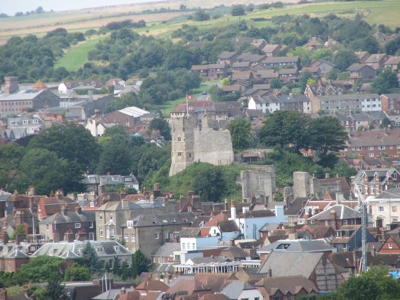 The Gorse Fox has visited Lewes Castle when exploring the town with the Silver Vixen. Though completely surrounded by a thousand years of urban growth, Lewes Castle stands at the highest point of Lewes and provides some wonderful views over the town.
The original fortification was a wooden keep, later converted to stone. It is unusual for a motte and bailey construction because it has two mottes. It was built in 1087 by William de Warenne, 1st Earl of Surrey, the brother-in-Law of William the Conqueror.
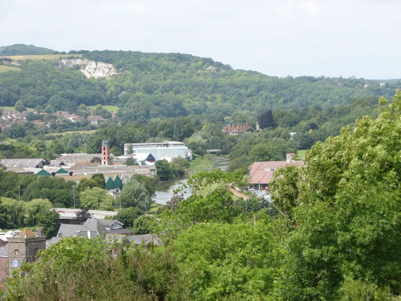 Looking across to the northern edge of Lewes you can see the River as it carves its route through the Weald, and the Downs rising again in the background. Gorse Fox was on that section of the Downs back in April
Down among the Bottoms
 Leaving Mount Caburn, the Gorse Fox started a long a straight descent. Several hundred yards ahead of him, another walker was blazing the trail. "At least" thought the GF "if there are any ne'er-do-wells hiding in the long grass, they will reveal themselves as he goes by."
Any regular reader (probably an insomniac) will know the deep affection GF has for the Downs. He must say that this stretch counts among the best. The soft grass shimmered in waves as the wind blew up the valley. The folds of the Downs promised to reveal more with every step. The shadows cast by the scudding clouds seemed to emphasize the diverse colours of the route ahead.
 This is an interesting spot. It is the nexus of Oxteddle Bottom, Bible Bottom, and Caburn Bottom.
There's definitely something wonderful about the Sussex Bottoms. They just seem to flow, gently sculpted into the landscape.
This picture shows Bible Bottom, and you can just pick out some old field systems as ridges in the slope at the back of the picture.

Beginning the climb up from the depths of the Bottom the view opened up once more. The field, though looking as if it has an orange hue in the picture, was a awash with small yellow flowers, purple flowers, and the feathering seed heads of the long grass. As the wind blew across it, it seemed almost pearlescent in the way the colours changed.
Caburn Fort
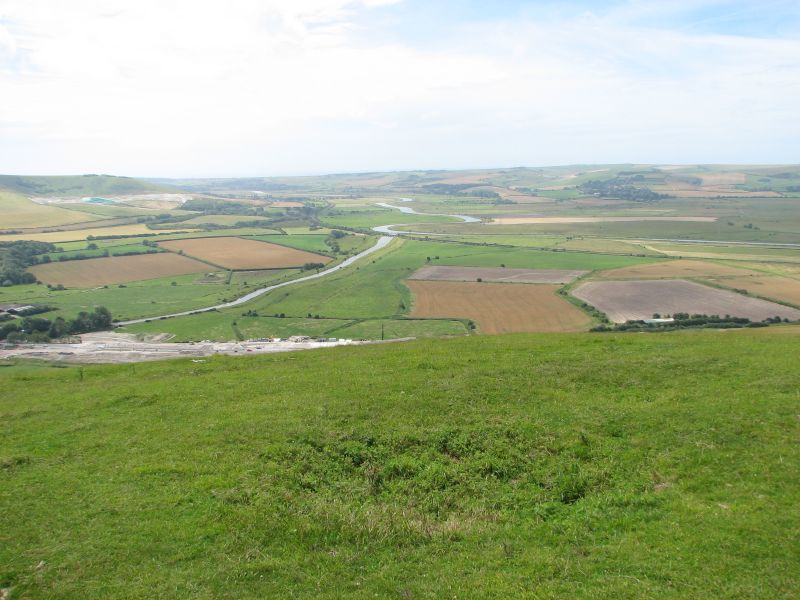 Traversing the last part of the climb, and negotiating the defensive ditches, the Gorse Fox found himself in the centre of the the old hill fort.
It is easy to see why it was built - providing panoramic views of the surrounding countryside and affording early warning of any unwanted visitors.
This is the view slight west of south along the River Ouse towards Newhaven and the sea.
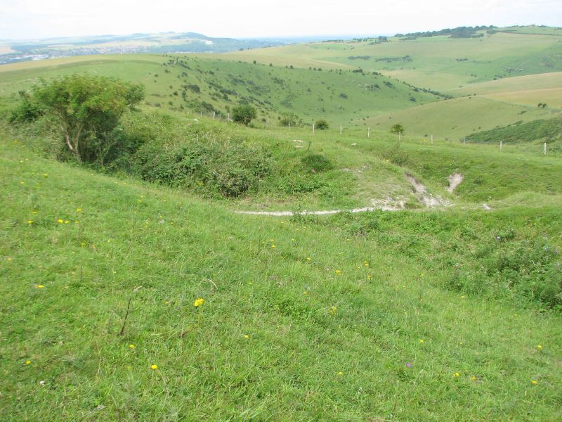 As with many earthworks, you tend not to see the defensive ditches and ramparts once you are within the enclosure. However, even after thousands of years of erosion, they are still fairly deep ditches, and steep ramparts and would certainly slow any marauding attacker.
Oh yes, and calling it a "mount" is obviously a bit of local humour. It's only 480 feet high.
According to Natural England: "The cultural history of Mount Caburn mirrors its wildlife value. The reserve contains the 'Caburn', one of the best preserved and most important Bronze Age hill-forts in Sussex. The hill's name probably derives from the Celtic 'Caer Bryn' meaning 'stonghold hill'.
In the 18th century, John Ellman, the local tenant farmer, developed the internationally famous South Down breed of sheep on this downland. Once the world's most important breed, the South Down is now a rare breed."
Follow this link for more information on Mount Caburn
Mounting the Downs
 After crossing a small field, the Gorse Fox had a straight, steady, and fairly comfortable climb.
The hummock at the top right is Mount Caburn - but more about that later.
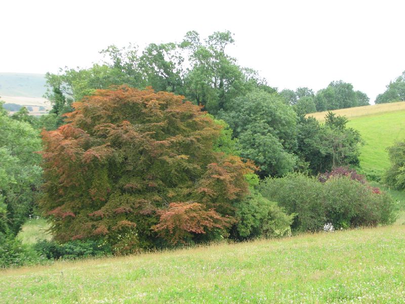
Looking down to his left there was a wonderful plantation of mixed deciduous trees. GF thinks they are edge on old disused Caburn Pit, but as he didn't go to investigate - can't be sure.
 Diverting off the path brought the Gorse Fox to the entry to Mount Caburn. This hill is now maintained by English Nature and is crowned by by earthworks stemming back to the megalithic era.
Starting at Glynde
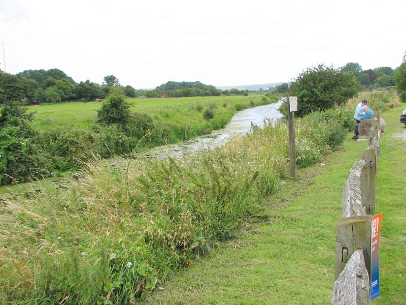 Just over Glynde Bridge is a little chalk car park by the side of the river. This is where Gorse Fox parked the car, then sat in the boot whilst putting on his walking gear.
Next to him a man of uncertain years (but certainly more than the Gorse Fox) sat in his car with the window open, listening to classical music. His newspaper was held open against the steering wheel. The river trickled by... all was peaceful.
At least it was until he dozed off and fell against the steering wheel. The horn blared. The peace was shattered. He sat bolt upright with the look of a startled rabbit trapped in the headlights. Then, realising he might have been seen he started to fiddle with the steering wheel and examine it as if it had been intentional.
 Chuckling to himself, Gorse Fox left the car park and headed in towards the village. It nestles below a cluster of Downs that separate it from Lewes.
The architecture is a bit mixed, stemming from a long history of use, but could be characterised as "English quaint".
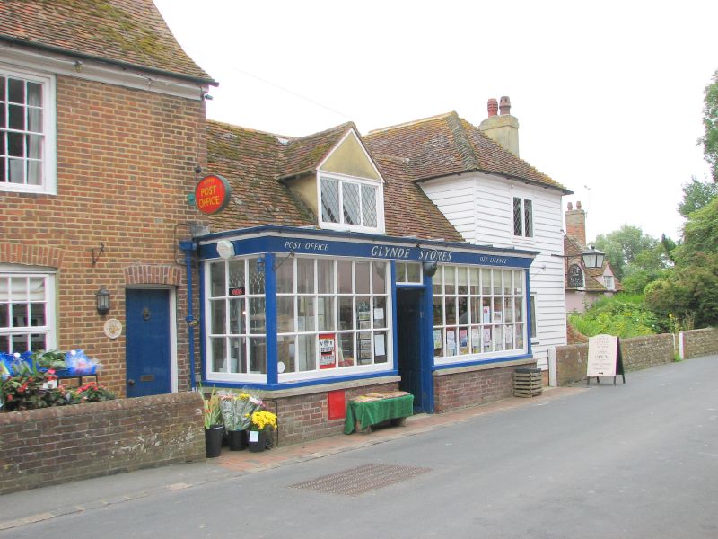 A small shop hides just round the corner from the main road through the village. It seems to be the only place in the village where the locals can buy anything (though, no doubt, there was a pub somewhere).
 And opposite the village store was this confection of pink
 Immediately after these cottages, a stile marks the start of the footpath up into the Downs... and the next stage of the Gorse Fox's walk.
Glynde - Lewes
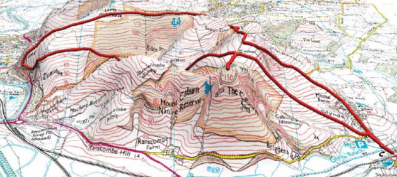 So today's walk started with a drive across into East Sussex, to the village of Glynde.
Starting at the bottom rightmost point on the map the planned route led into the village and then clockwise round the loop. The climbing, the route leads up to a high point, where a brief southerly diversion takes in Caborn Mount. Then plunging over the side you descend into Oxteddle Bottom where it joins Bible Bottom. Continuing westwards, the walk skirts the southern side of the Golf Club before turning briefly north with some splendid views over Lewes. At Cuilfail you start the return leg of the route - cutting across the golf course, skirting the northern edge of Bible Bottom, then along the edge of Saxon Down, before turning back south over Glynde Holt then down towards Home Farm and back to the start.
Subscribe to:
Posts (Atom)