The Gorse Fox has not published a walk for a while. However he was sent this link which he includes as a "guest walk". He hopes you have a head for heights!
Showing posts with label Walk. Show all posts
Showing posts with label Walk. Show all posts
Friday, June 27, 2008
Saturday, May 19, 2007
Malvern profile
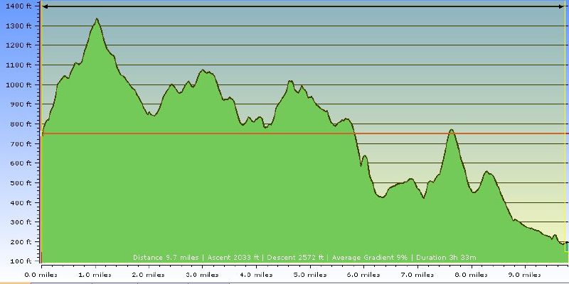 This was the route profile for the journey according to Tracklogs.
Distance: 9.7 miles (10.4 according to the GPS)
Higest Point: 1375 feet
Lowest point: 196 feet
Total Ascent: 2033 feet (3477 according to GPS - and the GF's legs).
Bromesberrow
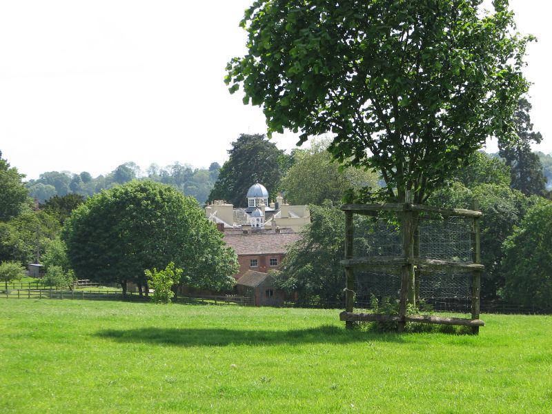 The final stretch took the Gorse Fox through the grounds of Bromesberrow Place, across some fields and along a country lane.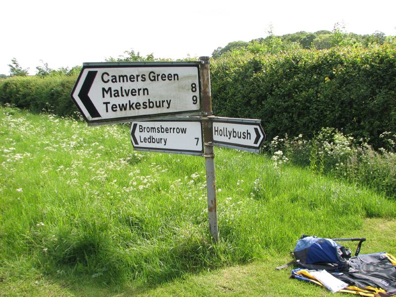
Finally. Chase End. This is where GF had agreed to meet the Silver Vixen. He sat down for the first time since the start of the walk, and relished the peace and stillness.
A great walk... well worth the effort. It was not as long as many that he has done, but it was quite hard because of all the ascents and descents
Chase End Hill
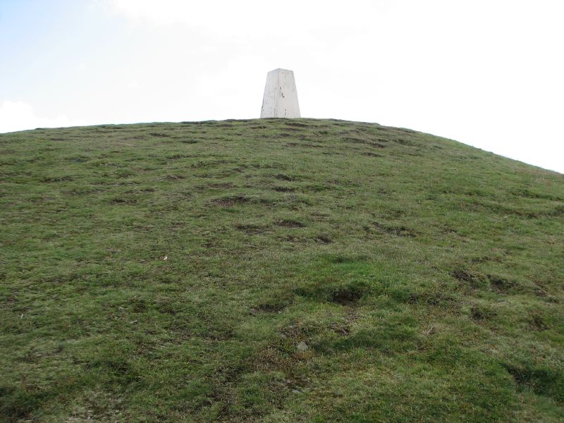 The final ascent to Chase End Hill was hard. GF assessed hi route-planning and realised he was luck to have one from north to south, so that the end of the walk had the lowere hills. As he gaxed up at the trig. point a few tens of feet above him he thought it was actually receding.
 Crossing those last few feet felt like a huge achievement.
It was all downhill (so to speak) from her on.
 Looking west from Chase End Hill, Eastnor Castle could be seen in the distance. It looked well worth a detour one day to have a look around
Hollybush
 At the next cutting ay a smal hamlet called Hollybush. It was small ribbon settlement straddling the road (A438) between Midsummer Hill and Ragged Stone Hill. GF had to wander about for a bit to find where the path led south up to Ragged Stone Hill. Eventually he found it, signposted "Three Choirs Way". He paused, listened carefully, but could hear not a sound. They were all evidently resting.
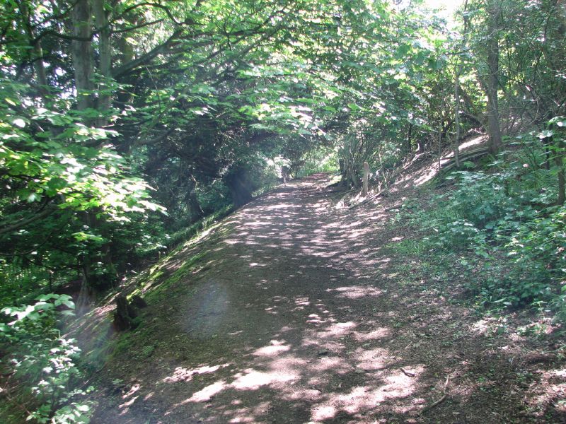 The Three Choirs Way led up and over the hill, but was deep in woodland throughout. This was all very fine and pretty, but the views were somewhat limited.
Threatening
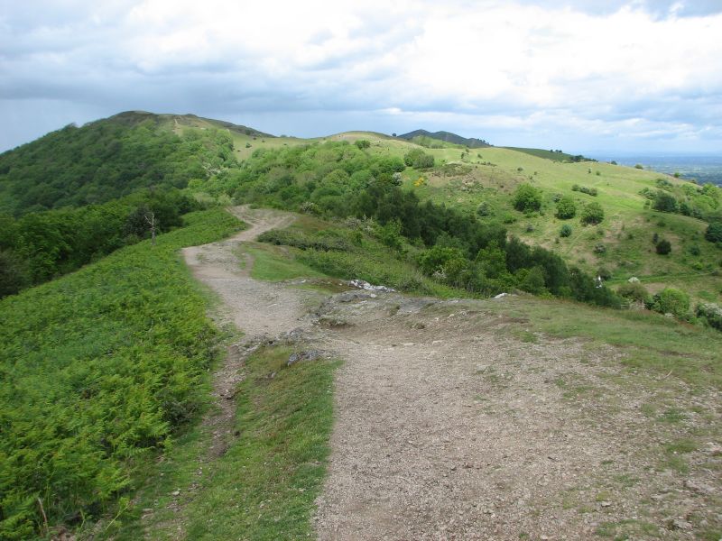 Pounding onwards, Gorse Fox was becomng aware of a further threat from Wales. Again a huge cloud was sweeping in from the western horizon, obliterating the landscape as it approached.
It was time to protect the camera again, and to snuggle back into the jacket. So no more photos to record the descent into the Gullet (another cutting) nor the traverse of Midsummer Hill and its fort.
At least this time it was just rain, not hail, and the wind was leass fearsome. This allowed GF to stay moderately dry.
Ditches
 This climb hurt. It had been fairly steep and GF found it hard going. As the view opened out, however, the sheer scale of the endeavour became clear. Huge defensive ditches stretching for many hundreds of yards had been dug in concentric rings around the hill.
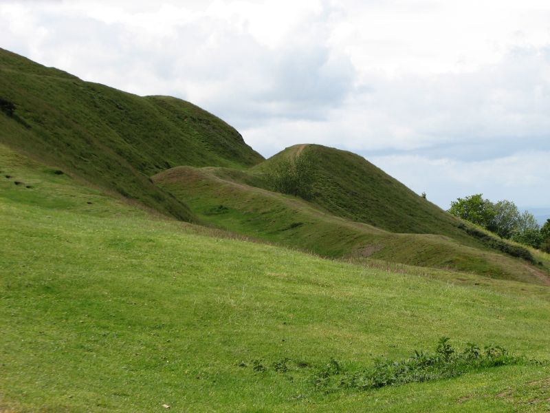 This ditch is, perhaps, the most startling and probably shows the size that they all reached before they were eroded.
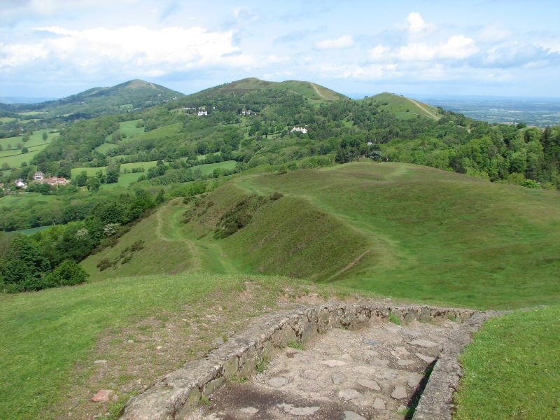 From the top the view was magnificent. There were still people about, but not as many as on the north hills. From here, however, those north hills looked deserted and GF was pleased with the progress he had made.
Well, pleased except for the worry that there were still 5 more summits to reach before the southern end.


Unbelievable
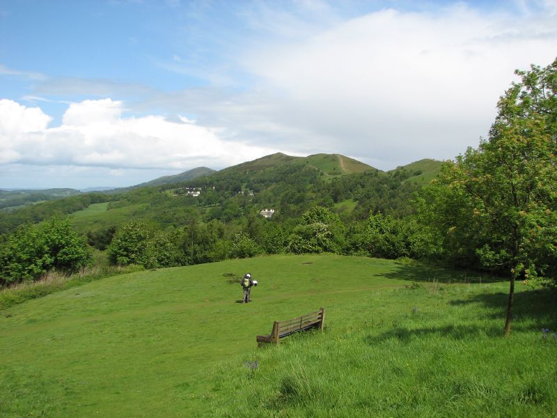 Blimey. To think what he's just walked through, and within minutes of the rain stopping the sun was it and it was all clear again.
Gorse Fox phoned the Silver Vixen to see how she had fared. She, however, was sheltered in the main hall at the showground and untroubled by the storm.
GF turned and dripped onwards... wet underpants are definately not conducive to an elegant gait, he concluded. Fortunately the wind was still blowing hard and he was quickly drying off.
He was heading for the next natural cutting in the hills, where the A449 cuts through from east to west at British Camp.
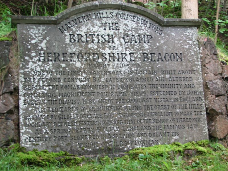 Arriving at British Camp, GF decided he was not presentable enough to venture into the pub. He looked like a mongrel that had been hoiked out of a canal.
Walking over to a booth by the road he was tempted by some fresh pasties that had just been brough from the oven. Shelling out his £2.50 he stood by the roadside and muched his way through one of the best looking and worst tasting pasties he's ever had. Glad of his trusty supply of sparkling water he washed away the taste, girded his damp loins and headed over the road to start the climb to the Herefordshre Beacon.
Premonitions
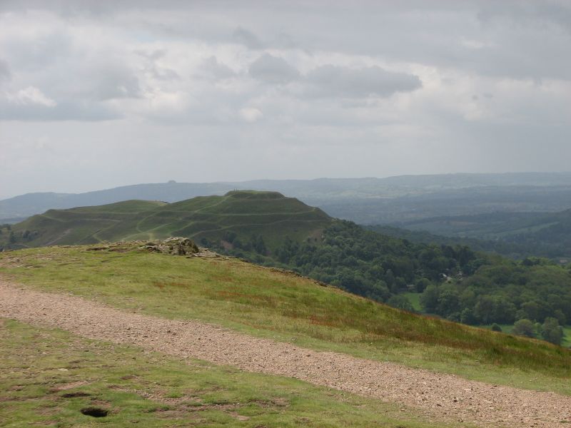
From Jubilee Hill there was (with aid of the telphoto lense) a good profile of British Camp (The Herefordshire Beacon), with its sculpted sides carved out by the defensive ditches of ancient man.
It was whilst looking at this the GF became conscious of the impending weather that was sweeping in from Wales. Just dark in this view, but slightly off to the right the rain could be clearly seen as it erased the landscape.

No time to hang around, Gorse Fox continued towards Pinnacle Hill and Black Hill.
Now this is where the photos dry up for a bit, because this is more or less where Gf was when theat Welsh weather hit. The camera was squirreled away in the rucksack, and the jacket zipped and button, and the hood raised. At that moment the first drops hit, and a squall blew in the wind was strong enough that it made it hard to walk, the rain turned to hail and visiblity plunged to a few tens of metres. Like many others, GF was caught in the open, and found the easiest approach was to hunker down with his back to the wind until the worst had passed.
There is something deeply unpleasant about being so wet that your trousers are stuck to you and there's a cold trickling sensation in your underwear (though on second thoughts, that might be preferable to a warm one). GF strode on through wind, strode on through the rain though, though his map was tossed and blown. But he walked on, walked on, with hope in his heart that their might be a pub at the next cutting!.
South of the Wyches
 After a few miles comes the first break in the mountains, and your walker had to descend to the point where the road makes the most of a natural cutting and links east and west at Upper and Lower Wyche.
Climbing from road level the Gorse Fox started towards Perseverance Hill.
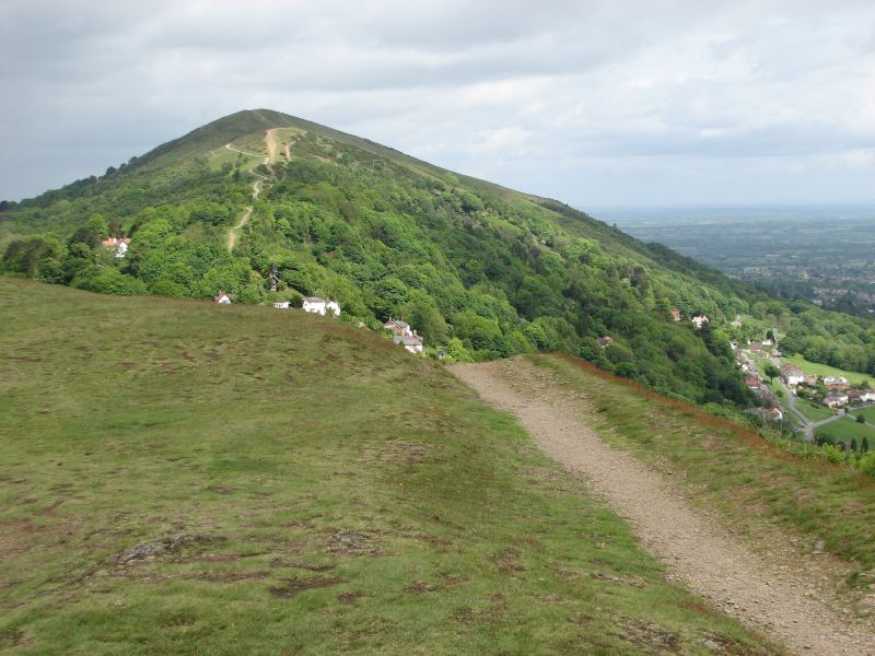
Nearing the top of Perseverence Hill there was another superb view back to the north, Summer Hill and the Worcestershire Beacon... with Lower Wyche nestling in the cutting
Back to Worcestershire Beacon
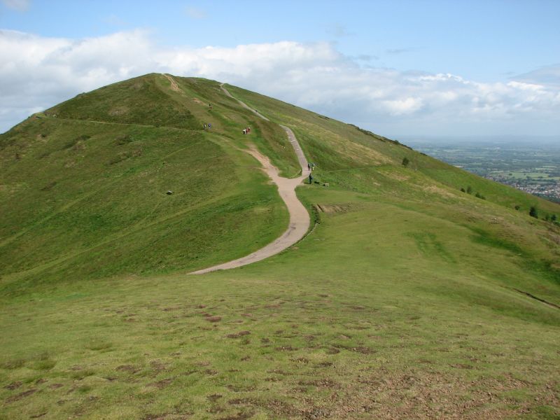 Striding on south, the Gorse Fox took one of many opportunities to pause and look around.
Dominating the view to the north, from whence he was heading, was the Worcestrshire Beacon, with Malvern just visible behind it, on the right.
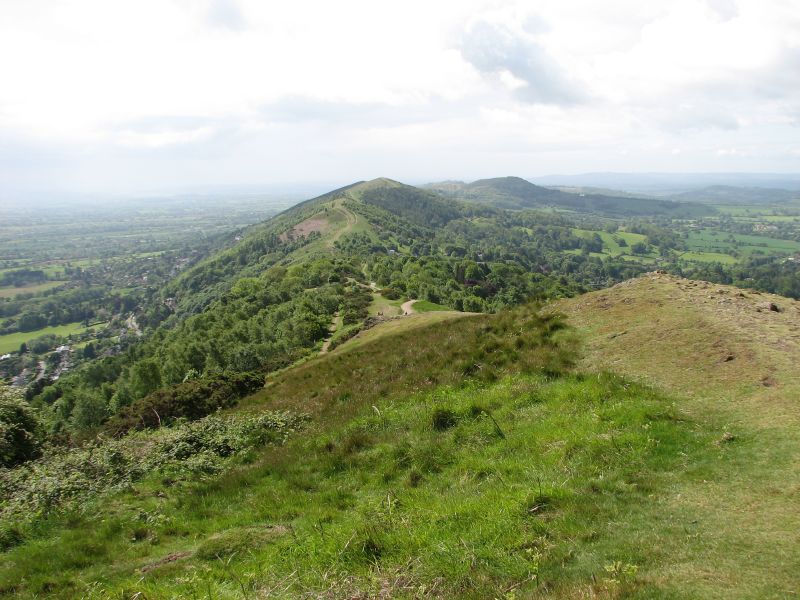
To the south the Hills just seemed to keep marching on, one after another. They seemed close as two dimesional points on the map and even looked close as he peered south, but as the descents from one and ascents to the next continued GF was beginning to realise that the third dimension could be a bit of devil.
The Path
 The path ahead looked pretty good but GF had noticed that most people seemed to follow the route round the peaks, rather than over them. This seemed a bit of a cheat so he determined he would go over the highest point of each (a decision that he would regret as the walk wore on).
This view showed the next few summits that he would have to conquer. Summer Hill was the next on the route.
Panorama

The view from the Worcestershire Beacon was quite breath-taking (and that wasn't solely because of the strong wind).
South the rest of the hills stretched out before him and then panning clockwise there were views across the Mocca Hills and beyond to the Black Mountains. Hereford and the Radnor Forest beyond. The Vinnal Hills; and, looking north, North Hill at the start of the Malverns.
This view has been stitched together form eight photos into a single clockwise sweep from south to north.
Beacon
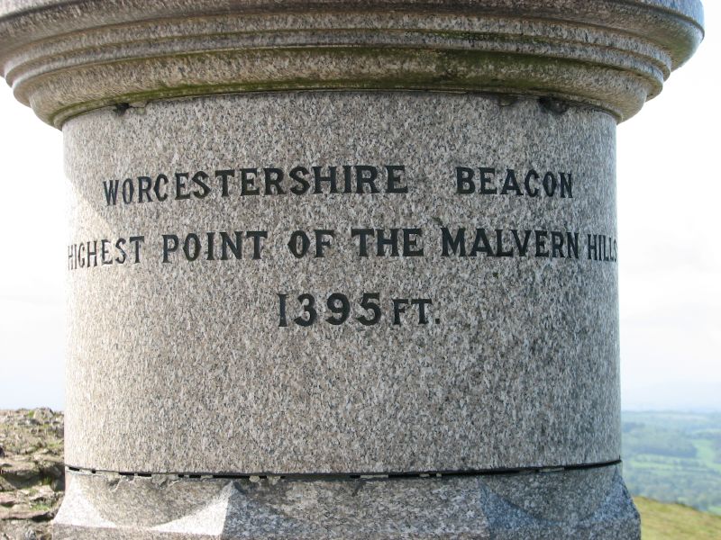 Well GF may have peaked too soon. 10:47 and he was at the highest point of the Malvern Hills already. This (he thought) is a bit of a doddle.
 The rain had stopped and the sun was out. GF was feeling rather pleased with progress.
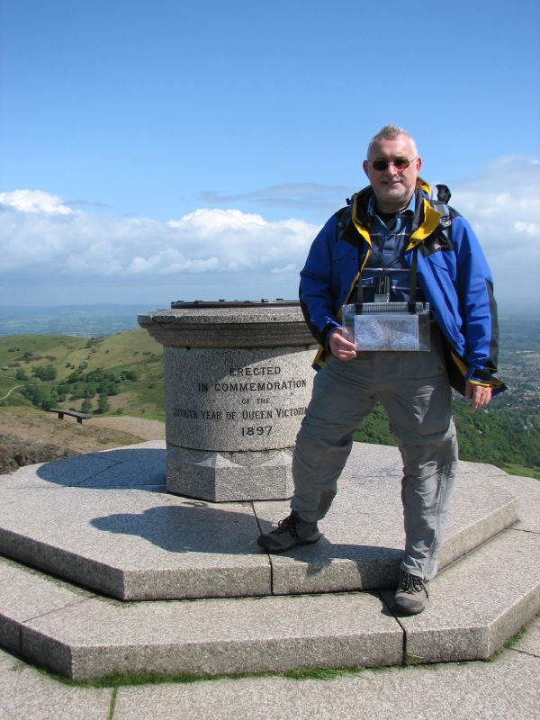 It was clear that some evidence of this momentous climb should be available for posterity, and he realised he had forgotte to bring a flag to plant at the summit, so had to make do with a photo taken by some passing youngsters.
Peering west
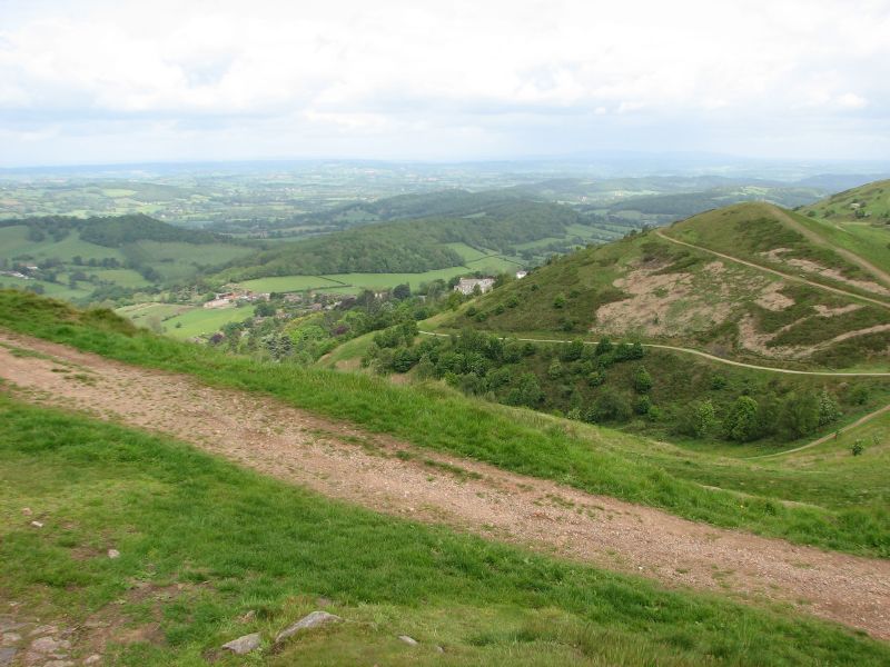 GF go his first good views to the north west as he started up the next rise.
The great advantage that the Malvern Hills have is that you can see into Wales without having to go there! certainly as the walk progressed these views to the west became one of the defining features... for more reasons than just the panorama. It was also the direction from which the weather was piling in, so gave warning of the next shower.
Getting worse... feeling better
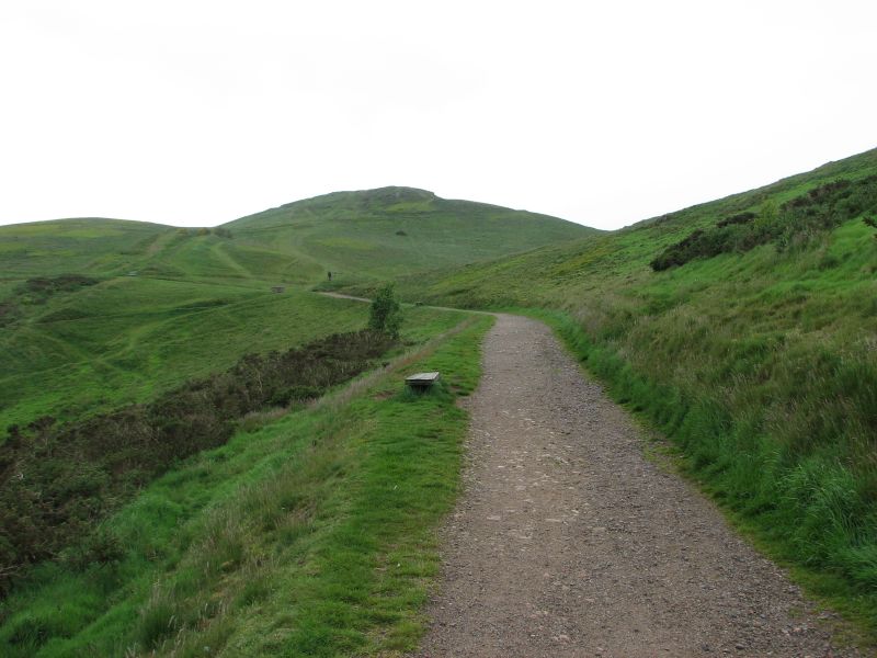 Arriving at the path that would take the Gorse Fox along the ridge, the rain started. This filled him with joy (not!) as he zipped up the waterproof and buried the camera in an inside pocket.
Now heading for south it was quite bright, so GF was optimistic that the shower wouldn't amount to much
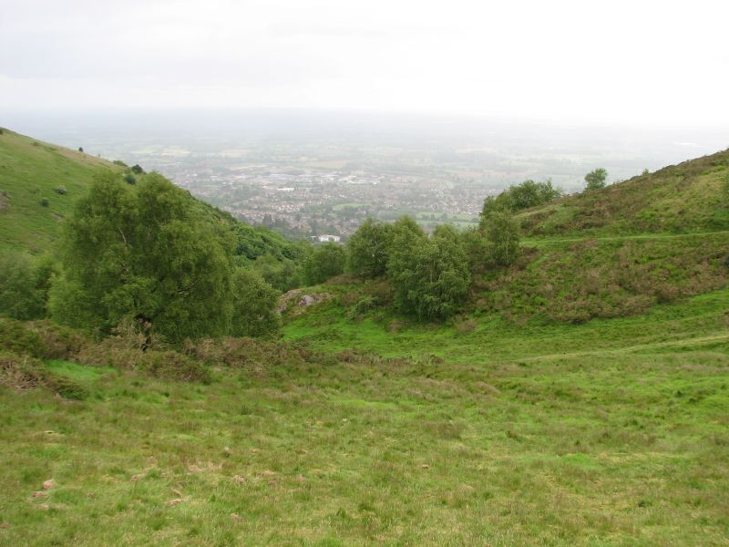 Below the view opened out and there nestling at the foot of the hill was the town of Malvern, all but obscured by the rain.
 Now GF was on the path and beginning to eat up the distance to the next hill, he was beginning to feel quite buoyant. This was going to be a good walk!
A bad start
 GF had looked up the OS Grid reference fror the start point of the walk, then used a website to convert this to Lat/Long and programme this into the SatNav.
Something somewhere must have gone wrong, because as the Gorse Fox emerged from the trees having slogged up the hill from where Silver Vixen had dropped him, he realised he was on the col between North and St Ann's... and so he had missed the first hill of the planned walk.
He debated a detour to the top anyway, but decided that was a bit daft, and headed up for the path along the ridge.
The Malvern Hills
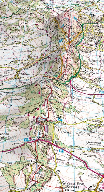 Gorse Fox made the most of his weekend in Worcester. The Silver Vixen was heading to the Three Counties Showground for a Quilt Show... but not before she dropped GF at the northern end for the Malvern Hills.
the plan was the GF was going climbe the hills and walk peak to peak all the way to Chase End at the southernmost end of the hills.
The forecast was fair with possible showers... so the waterproof jacket was within easy reach.
The route doesn't take much explaining - go to the top, walk southbound along the ridge all the way to the end.
Subscribe to:
Posts (Atom)