The ramblings of an aging body housing a mind that still thinks it's 25!
Search This Blog
Saturday, May 19, 2007
Malvern profile
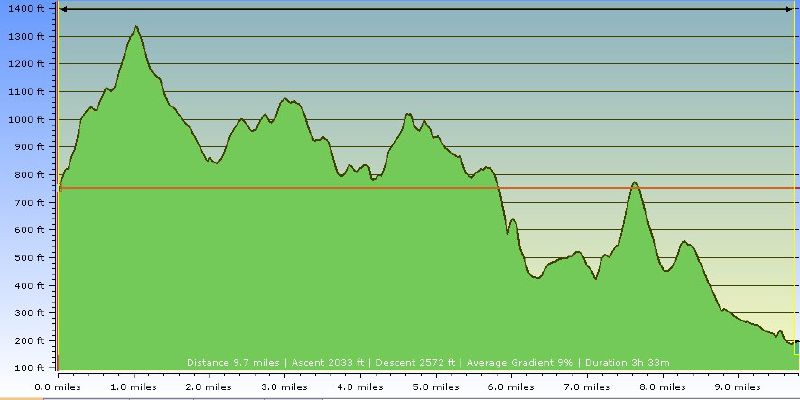
This was the route profile for the journey according to Tracklogs.
Distance: 9.7 miles (10.4 according to the GPS) Higest Point: 1375 feet Lowest point: 196 feet Total Ascent: 2033 feet (3477 according to GPS - and the GF's legs).
 This was the route profile for the journey according to Tracklogs.
No comments:
Post a Comment